Due to the pressure of competing interests, mostly my daughters, I'm posting the body of my post to the Drina inner circle as is here. I just don't have the time to seperately update the blog at the moment, so this is all you get for now, I'm off to polish tables...
The days just slip by and here we are on the day before New Years eve, I'm even starting to look forward to the fireworks...
I've include Drina's last two communications below with the usual bits included/missing depending...
When reading Michael's reports it easy to believe that it's all under control and a bit of a cake walk... I also get to talk with the technical officer from time to time and as a contrast to Michael's laconic tone I give you her latest view in a single phrase ("We are being blown all over the ocean like a beach ball at a Jimmy") I have no idea what a Jimmy is and I'm not sure I'm game to ask. I've Goggled the term without any success. Anyone know?
Drina's Navigation Station.
So here's Drina...
"Dear Kerro,
Many thanks for all the messages for New Year and Christmas. It is very difficult to send out individual replies to everyone. Could you please thank everyone on the blog/mail list you put out.
I do appreciate the news you send, but the 2nd. last one was only partly received., IE No weather as sailmail amended and said they only support a max of 1 kilobyte.
After I finished yesterdays report. and dinner was over we had a increase in wind so put two reefs in. The wind built up to the 35/40+ knot range with max gust 51 knots during the night. The wind was from the NW and we averaged 9 knots for the ten hours it lasted . So was a Vuncomfortable night. It is now after midday our time and we are still in NW winds but only around the 25/30 knot so all sail is up including the mizzen and we are getting along at 6.5+ knots on a course off 87°True.
Last Noon to Noon was 187 miles which is the best so far. Sun is out and seas abating.
Position report 2010-12-29 2030hrsUTC, 43°25'S 95°50'W SOG 6.5kts, COG 87°T and only 971 miles to go,
I found that last weather from Chile the best so far. It forecast the storm we had last night. So more of those please. I don't really find the Aust/NZ reports you send off much use now. The GRIB files we get did not show last nights winds, but direction in them was OK and where
the highs and lows are is shown.
We are in good spirits., and happy to be in the final 1000 miles. Even last night's wild ride with too much mainsail up, has not dampened our spirits, we were so HAPPY to be clicking the miles off. Even now at a sedate 6 1/2 knots with relatively calm seas the ride is OK and sunshine is most welcome.
PNA at 84c is good news too? I suppose Wild Oats should be disqualified, especially as yachts such as Swish rightfully retired because their HF not working at Green Pt?
We will be having Champers for New Year eve, Technical Officer is trying to decide if we should celebrate for Brisbane's at 0800. Sydney at 0700, Local Midnight here, Chile 2100, NJ 2300 or UTC 0000 or all 6 times?
You and GT have a good one
Cheers Michael"
And here is the previous mail received 29th December EST.
(PK Comment, The other yacht mentioned below, that passed relatively close is the SV Nereida owned and sailed single handed by 68 year old Joanne Socrates who sailed out of Victoria harbour BC in non-stop circumnavigation via Cape Horn early in October 2010. She has been at sea for 63 days. Her latest position report puts her close to Michael and Alex onboard Drina. Her web site does not allow copying so I can't show you a picture.
here is a link to Nereida's latest report for those interested in her description of the conditions.
It is now our Tuesday at 0530 local,1230hrs UTC 0n 2010-12-28 and we have 1206 mile to go, position 43°31'S 101°13'W, course is 88° T, speed 5.0 knots, as you can see the wind has dropped
out about 1 am, so won't be much miles today.
We had news from Don and Priscilla, (American cruising friends) that we have a yacht 360 miles SE off us with a 68 year old Jeanne Socrates attempting to be the oldest lady to circumnavigate unassisted on her yacht NEREIDA which is a Najab class (Know anything about the class?) Don't know what nationality, maybe you can Google and let us know etc. Vexcited to know someone else out here.
It is now 1730 local, 0130hrs UTC on 2010-12-29th Position 43°29S 100°01'W course 93° True speed 8.0 knots, overcast, raining wind up around the 30+ knots from the north again, it got back up about 0900hrs my time.
Yesterdays noon to noon was 150 miles and we have 1,110 miles to go, Tech Officer is cooking fish for dinner so will close this message for now.
Well, that's the festive season over for a few days! The rain that held off for the Christmas day celebrations, arrived early on the the 26th just in time to dampen our spirits and cause the cancellation of a trip to watch the start of the Hobart.
ROLEX / Carlo Borlenghi
Yuuzoo
Yuuzoo heading South into the freshening South Easterly.
Here's a YouTube video of Yuuzoo in last years race...
And now on the morning of the 27th the expected Southerly is firmly in accompanied with overnight rain and markedly lower temperatures. Wild Oats was first to mark Zulu and when last reported there was leading the fleet into Bass Strait. Here are a couple of reports, the first courtesy of the CYCA site and the second by Di Pearson reporting for Rolex.
"The Mark Richards skippered 100 footer, Wild Oats XI, shrugged off a cheeky challenge from Grant Wharington’s Melbourne 98 footer, Wild Thing, to stamp its mark early on the Rolex Sydney Hobart line honours battle.
Despite forecasts that this will be one of the toughest Rolex Sydney Hobart Yacht Races in years, the 87 strong fleet started in remarkably mild conditions on a flat Sydney Harbour at 1pm today in an 11 knot west-nor-westerly breeze.
Both start lines reported clean starts as nearly 1000 competitors began the Cruising Yacht Club of Australia’s Aussie yachting classic under overcast skies in a light wind that produced a colourful spinnaker procession out of the Harbour before the fleet turned at the seaward mark to point south towards Hobart.
On the eastern side of the front start line, reserved for the largest boats, Grant Wharington staged a nail-biting and brilliant start with just seconds to spare at the helm of Wild Thing. The 100 footers, Bob Oatley’s Wild Oats XI and Sean Langman and Anthony Bell’s Investec Loyal squared off on the western side, while Stephen Ainsworth’s Loki timed things perfectly about a third of the way down the tightly congested line.
As Wild Oats XI and Investec Loyal sprinted down the western harbour shore, Wild Thing steamed along the eastern shore in better pressure past Vaucluse and Watsons Bay.
Wild Oats XI won the sprint to the sea mark, 13 minutes 48 seconds into the race despite trailing her jib briefly in the water as she changed to her light Code Zero sail minutes after the start. Once she turned seaward, Wild Oats’ Code Zero made way for a giant spinnaker as the four-time line honours winner gybed to find the shortest route to the seaward mark.
Two boat lengths behind Wild Oats XI, Wild Thing and Investec Loyal converged on the harbour mark, Wild Thing squeezing her rival out as she slipped inside.
Investec Loyal immediately headed towards South Head and Wild Thing held her course toward the north, looking for the pressure advantage they needed to have any chance of mowing down the leader in these flat conditions.
The gamble didn’t paid off for Wharington, who also had an incident with a media boat just inside South Head, and by the time Wild Oats XI was at the sea mark, the point at which the impressive fleet converged and gave chase and turned the sea into boiling whitewater, the thoroughbred had opened a handy break on her line honours rivals.
The last boat to leisurely leave Sydney Harbour was the Italian entry Onelife, one of two entries in the Cruising Division.
Sometime this evening the fleet will encounter a southerly change of 15 to 20 knots accompanied by scattered thunderstorms."
And...By Di Pearson, Rolex Sydney Hobart media team
"Bob Oatley’s super maxi Wild Oats XI has led the 86-boat Rolex Sydney Hobart Yacht Race fleet into the notorious Bass Strait this morning, with Sean Langman’s Investec Loyal and Grant Wharington’s Wild Thing in hot pursuit.
Langman and Wharington’s yachts are level pegging, but the two are sailing either side of the rhumbline, some 20 nautical miles behind the leader, Investec Loyal to the east and Victorian yacht Wild Thing to the west. The lead boats are sailing in a squally sou-westerly in the 30 knot range.
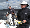
Sean Langman’s Investec Loyal
Another battle is taking place just 10nm astern of them, as Matt Allen’s Jones 70 Ichi Ban (NSW) and Peter Millard/John Honan’s 98 footer Lahana (NSW) are within a mile of each other to the east of the rhumbline.
In other news, the NSW yacht She has reported a head injury to crew member Colin Apps, who was reportedly seasick and fell, bumping his head and sustaining a head injury.
She will liaise with the police launch Vanguard, which was following the fleet. Vanguard is towing an 8 metre rib, which will be used to transfer Apps off the boat. The boat will take Apps to Ulladulla where an ambulance will be waiting.
Further news will be available as it comes to hand."
And now back to Drina en-route to Puerto Montt, Chile. I've been a bit tied up with family stuff for the last few days so the last report of Drina's progress posted here was 17 December UTC. A lot has happened since then and though I've posted updates for the e-mail list that stream doesn't always get posted here. So to bring this blog up to-date I've included all the position reports since to 17 Dec UTC below in date received order. So, to the extent any one-sided conversation can, it should read like a narrative. I have redacted some content to protect both the guilty and innocent alike. I have also provided comment by way of explanation where I thought it was needed. My comments in italics.
Here's a picture of Erich's beautiful double ender, designed bythe renowned K. Aage Nielsen of Boston and built by one of the finest Danish shipyards, A. Walsted of Thuro, that I mentioned in a previous post.
And now to Michael's adventure once more...
"Dear Kerro,
I note that yesterdays eamil for some reason was not sent, hope it goes out tonigt. So just a small update for now.
We had great excitement today as we saw and spoke to them. It was the Papua bound for NZ with Ukraine Master.
Last night was frustrating light South wind till midnight when it went to SW and still light, it is now W about 15 knots so we are wing and wing and gliding along around 6 knots. Alex is preparing dinner. Some kind of chicken dish, nice aromas coming from the galley. Been overcast all day., only one Albatross today. Alex spent sometime trying to find a whale without success.
Here's the techical stuff; Position at 0400 21.12.2010 UTC 44°30' S 129° 07'W, 2384 miles to go, speed 6, course 90° true, noon to noon was 137 miles.
rgs michael
Seems they passed a ship in the day or perhaps night
I sent my first emails out last night, I have had to be sneaky to find out how it works. while the Technical Officer was busy watching a movie I had a go. And it seems success!!! Now have to work out how the position reporting and the GRIB file stuff works...
I am at a loss to what is happening re the fans etc, no idea I was so famous. How did folks from Germany find out I was on way to Patagonia? How did 'Ernst find out? he is the one who I met in Samoa and inspired me to this madness to go to Patogonia in the first place? How many are following us now?
If you see Jimmy tell him I have figured the transit to Puerto Montt out as equal to 9 Hobart's. So if we take around 9 boats in the 50 ft range doing it this year and add up their crews, breakages, injuries, costs, food consumed, nights at seas, squalls encountered etc. we have a idea what it is all about.
Today's report is 1800UTC on the 21st, Morning here, overcast wind going light down to 8 knots from the west, but expect it too pick up in 8 hours time again, we have a low behind us, Bar is 1024
Posn 44°39S and 127°02W with 2294 miles to go our course is 94°T speed 5.5 knots
Hold on the sun has just come out. Will send more news later.
rgs Michael
Postscript; Dear Kerro,
Just adding to this email, it is 0315UTC 2010-12-22 position 44°50'S 125°58'W speed 5 kn course 87°T
wind is from North abot 8 knots, clearing skies, cooking fish for dinner, been a slow day noon to noon was 150 miles. 4-5 m swell from the SW with little sea from W.
Yes it was a Ship that passed 5 miles away bound for NZ called PAPUA< with Ukraine, Polish, Phillipino crew.
thanks for latest weaather, find the Chile part fasinating for P Montt area. We seem to be missing the worst of the gales at present but it is a long way to go yet...
I note the ice edge is 1020 mile south of us, I wonder if that means the ice edge or limit of ice bergs?
I sure would not like to run into an ice berg. But would be neat to see one?
And here's another one again out of order... Wonder if Michael's been playing with the computer again?
"Dear Kerro,
We have had dinner of lamb shanks with roast vegetables and have been watching the sun go down whilst enjoying a rare xxxx beer. Not as good as yesterdays sunset which was a real beauty. It is just past 2000 hours local time and we have another hour of twilight to go. It is almost full Sun now which is nice. Sun comes up around 0330 am so we only really have 7 hours of night now. Yesterday was good sailing and we rolled out 162 miles in a westerly breeze runing wing and wing. About midnight it went around to the South and lightned off, so have been reaching since then and only achieved 129 noon to noon. It is very light wind now of around 8 knots and we only have boat speed of around 5 knots.
We are on the great circle course which is taking us south, which I hope will get us under the high we are in. Bar was 1030 at midday and has droped to 1028 as of now, If we get below it hope to pick up strong westerly winds. We only have 2500 miles to go now.
We're still eating the tuna for the last three days and enjoying it.
The technical officer has been doing the midday position. We have settled in to our watches properly now and I have a afternoon siesta, practicing for the Spanish way of life in Chile.
Chile seems to be getting closer everyday now. We still have about 6 or seven days till we are on the next chart which will show Chile at the end??
So our technical information is 2500 miles to go at 0525 on the 20 th Dec UTC. Position is 44°06'S and 131°57W and wind is from South at about 8 knots. Bit of cloud cover with a short sea from the South and a very low Westerly swell.
Not many birds today., just a few Albatross early in the morning when there was more wind.
Thanks for the weather and latest news on cricket etc.
Sorry no email on follow up off small email in morning yesterday, but technical officer busy on the computer so could not get near the terminal last night.
It is now just after 6 am local time, and after yesterdays wild ride things are considerably better.
The skies did clear yesterday afternoon for a while, but by 1800hrs we were in fog with drizzle and the wind dropped off for a short while which tempted me to let the third reef out and as the wind shifted a little to NW went to reaching with full headsail.
This lasted a hour or so while we had dinner and then back up to the 30 knot range, so last night ended up with 2 reefs and half headsail running with the the wind on our quarter and found it very uncomfortable with the left over sea running and we were rounding up on the auto a bit. It is now much better with two reefs and full headsail in around the 20 - 25 kn range on our quarter from the NW. But is very, very cold, heater on and overcast with a drizzle. Seas abated a lot, expect this weather will be with us for 3 days or so.
So here's the technical bit, position at 1425 UTC on 2010-12-23 is 44°27'S and 120°04'S and 2007 miles to go. Course 80°T Wind W x NW 20/25 knots T. Noon to Noon 160 miles.
Yes we are going to have another party today, cracking the 2000 miles to go and a new chart starts 120°West which shows our destination at last on it and has a better scale.
With regard to engine, only running it when the wind drops out, it is now three days since we ran it, water generator and wind generator are keeping up with all our needs, the water generator is making an outstanding contribution, saw a lot of 12 amps from it yesterday. Mind you that was a pretty wild ride. We have used around 250 litres of fuel which was mostly in the light conditions on leaving NZ We still have one fuel bladder on the aft deck holding 170 litres.
Thanks for the Chile weather, the Port Montt to San Pedro is the relevent one, later when we get close.
I have been informed from a friend Peter Smith on Kiwi Roa who is at present in Falklands that Max sea is accurate for my landfall. Sorry Kerro, never did get a proper chart. The tide range there is 20 ft plus with up to 10 knots in the channel, so have to get tides right, there is a manned lighthouse in the approch which gives info and a good anchorage by the lighthouse to wait for the right time. It is about 60 miles from there to Porto Montt.
Our food is holding up well, so still have 4 beef roasts, 4 lamb racks, Chicken breasts, lamb shanks, sausages, carrots, boroccli, potatoes, onions, apples and oranges in plentyfull qtys.
Two sleeps to Christmas and hope father xmas comes as we have a chimney now by way off the diesel heater flue at the mast.
rgs Michael.
Postscript. It is now late 1600hrs local afternooon and we have just finished dinner off Lamb Shanks. The sky cleared a bit so had it in the cockpit for a change. Today has been good, shook out the reefs midmorning and went to wing and wing, been a good day with seas abating and winds in the 22 knot true range.
And later... Christmas eve!
Time is 0330 UTC 2010-12-24th, position 44°22'S and 117°54' W on a course over the ground of 83°T speed 7.5 knots Bar is 1010 steady. Air temp 14.1°C water temp 6°C.
Wind west at 25 knot true, full main and winged headsai, Christmas carrols fill the cabin, decorations go up tomorrow weather permitting. Todays noon to noon was 170 miles and we have 1916 to go.
It is Our Xmas eve and we have had dinner and it is 2045 local time. We have two reefs in main and a little headsail poled out wing and wing running in about 25 to 30 knots with a nasty following sea, but progress is good 166 miles noon to noon. Christmas lights are up in the cabin., so the crew is happy.
The sky is clear one moment and then overcast again on and off.
Technical stuff, 2010-12-24 Friday 0345 UTC position 44°21'S and 113°50'W, speed SOG 8.4 knots and course 99°True,
barometer 1010MPa temperature 15.1°C, 1743 miles too go, so close now?
We have not run the engine for five days now, the water generator is putting out heaps at these speeds.
Looks like tonight will be a bumpy one., I am hopefull we will be having this wind for another five days.
It is Xmas morning here and wish you had a good one yesterday.
Wind got up after dark last night and we are running hard in 30/35 knots with a nasty following sea, bit off rounding up occasionly, the Auto working overtime and only just copes.
The technical stuff is, Position at 2010-12-25 1450 hrs UTC, 44° 37'S and 112°05'W, course 100° True, speed 7.5 plus, 1667 miles to go. Barometer 1005MPa dropping and from grid files expect this to last another 20 hours or so.
Xmas decorations went up yesterday.
Look forward to easing weather as the motion is vbad, but it is good progress.
rgs Michael
It's now 2100 local time and the winds abated a little , around the 30 knot more , but a big swell running, wind shifted to SW.
Technical info at 2010-12-26 0400 hrs UTC Position 44°21'S and 109°43'W, course 65 True, speed 8.8 kn, Noon to Noon was 178 miles, to go 1569
Was a wild ride today, few seas climbed into the cockpit. As I type wind getting up again and it is raining a bit and overcast, so it will be another night off tossing etc
Do thank, if you can, all the team who sent their best wishes for Christmas.
Yes the Aust/NZ weather report is no good now, especially as we are past 110 West. I am trying for one week to get the Chile weather map on my weatherfax without success yet. So relying on your MetArea 15 stuff and GRIB files.
It is 4 am here and sun is coming up, have just gybed the main as wind has lightened and swung to SW by W.
Speed only 6 now, Date is 2010-12-26 UTC 1100 hours position 44° 04'S and 108°41'W, 1525 miles to go and new course is 87 True (Great circle is 97 True) It is vcold and overcast.
Apologies for the delay in this post, blame the festive season. I'm still having a few problems with the Yotreps site support guys. We (Drina that is) are now back on the web site map outputs, however the summary database reports that I rely on are not reporting a position for since the 4th Dec...
Erich Brosell, whom some of you will know, (Erich raced his beautiful yacht 'Holger Danske' with friends on the Derwent and in the D'Entrecasteaux Channel South of Hobart with success against Drina during the Circumnavigation of Tasmania some years ago.) has posted his guess at the arrival time (ETA) for Drina at Puerto Montt. So I wondered if any other of you Navi-guessers on the list want to have a crack at Drina's ETA? There are no prizes, (other than bragging rights), if I get any guesses I'll post them as I get them. To start the game I'll post Erich's and my guesses here.
Erich Brosell = "I have marked the 7th of January, 2011 as ETA for DRINA in Puerto Montt"
PK = "0400UTC on the 8th January, 2011. I think Mike will wait for the right tide and have a look around before making the final entrance."
Oh! I won't tell Michael what the replies are until he's there.
So here's the latest form Drina.
"Dear Kerro,
It is 1900 local time and the sun is setting.Another few hrs of twilight to go, we have about 7 hrs of darkness at this latitude or did I tell you that already? We have had a good day sailing,
In the morning doing 8 knots plus with wind from the north and all sail set, wind still from the North and has lightened off so doing around 6 knots now.
The noon to noon was 165 miles, if we could keep this up we'd get our 1000 miles per week no trouble.
Position at 0500 UTC 42°57S 138°23W 2010-12-17 17, wind North at 12 knots, speed 6 knots COG 93T
bar 1022 temp 15.5 clear skys, little swell, 2795 miles to go.
We had our half way party last night, too bad you missed it. We did have two reefs
in all last night though...
Very little sea life at present and looks like we are catching up the high in front off us.
here is another verbatim report from Drina minus a few of the duller technical bits. More than one or two of you have asked if I could cut the numbers and up the word content... Looking back at some of the recent posts, I'm inclined to agree, however I'm stuck with what the adventurers send me. And if I cut out the numbers, what's left? I've passed on the comments to the authors afloat and suggested they make it more interesting for us voyeurs. So far no to no effect apparently. Here is the latest from Drina.
"Dear Kerro,
It is 1800 local time and 0300 UTC and I am informed by the technical officer we are exactly half way
to Chile from Brisbane, 2959 miles to go, Puerto Montt here we come...
Position 2010-12-16 at 0300UTC is 42°44'S and 142°18'W, our COG is 93°T, SOG is 7Knots.
Sky overcast, wind from N by NE around 20 knot, have stowed mizzen and staysil as we are a bit close on the
wind for them now.
Alex has baked a cake for our half way party, what is the difference between baking
powder and baking soda? We have soda?
Sea is "reasonably flat" but we are leaning a fair bit, Hope for another good night, I am told we did 150
miles last 23 hour. Really 24 but we advanced our ships clocks another hour, that means another 15°of longitude under the keel... Oh and fresh Fish for breakfast lunch and dinner!
Thanks for the weather, it's starting to be critical (as we are getting some good GRIB files though, they are hard to interpret for the troughs, fronts and ridges, having the text reports really helps sort that out.)
Nice to get the news. We have no radio reception etc. for world news.
Only excitment today was a flock of Black Terns spending the afternoon trying to catch our lure, which is now a long way behind us. The albatross
that's been following us seemed quite concerned by Terns behavier, Albatross know not to go after lures. Now, live fish on the long liners hook that's a different matter! Then just before dark (now about 2200 hrs) right on dinner time we pulled in a good size tuna, Alex was delighted, as red meat is not great for a Veggie person and I'm getting a bit sick of stews. Now plenty of room in the freezer so I think we have enough fish for about two weeks.
Sailing has been good, yesterday afternoon had Westerly around 18 knots and at around midnight it switched to
North at around 12, Daybreak has come and we have mizzen and staysail going and wind is increasing and up to
18 again so we are reaching on a course off 90 True. The GRIB files you mentioned are a little off, we've been getting westerlies for sure like they predicted. However, I've had a few weather maps for south pacific from NZ Weather last night via the weather-fax and also our own Sail-mail GRIB files, these predict today to be North. Tomorrow North, next day NW and in five days Southerly around 25, so hopefully some miles to be made. This doesn't agree with your GRIB forecast of westerlies going south westerly over the next 3 days. Maybe your files are based on the US model? perhaps you could check! We are currently pressing along in the 7 knot SOG range.
So our position report at 1600 UTC, 2010-12-16th Dec. Pos 42°44'S and 144°13'W, course 90° True, SOG = 7 Knots., Sky overcast,
but good visibility on a low westerly swell. All well on board.
Reports, weather fine, blowing 18kts from the east, All sail up hard on the breeze for the last 3 hrs. Clear skies with half a moon with hammer heads on horizion to north.
Been hove too for the last 18hrs with only a little motoring to charge batteries and keep the fridges down. Getting through the reading material at an alarming rate, looks like we will finish all the books we brought before we sight land...
GRIB files are OK except they seem to be predicting for today the conditions we had yesterday... Maybe it's a date thing...
The mystery of the reports not being in sync with the time-frame required by the tracking station is ongoing... Watch this space, I was promised a fix by Monday and here we are Tuesday and ....
So once again I'll post the mail mostly as received with a small number of personal redactions that will make no difference to you lot. However I've been asked to add a few explanatory remarks by one or two on the list so here goes...
GRIB files are digitized weather maps scanned and transmitted by a network of voluntary Ham HF radio stations around the world for the use of small ships at sea. (think Facsimile machine) Once received onboard Drina they can be layered onto the mapping software on the laptop and display a weather map at the location of the ship.
Sailmail is a similar network of voluntary Ham HF radio stations, however this group provide a messaging service similar to SMS on your mobile phone. The length of the message is limited, ASCII characters only are allowed, no attachments and messages with pictures or other format enhancements will be rejected. The key difference is that it operates on a schedule and is not therefore real time, there is a delay between transmission and receipt.
UTC Coordinated Universal Time, (why it's not Universal Time Coordinated is subject of another mail) it's not the same as Greenwich Mean Time, GMT the solar time at the Greenwich Meridian or 000°Longitude. However, for our purposes and everyone else I can think of except atomic scientists it's the same thing. Sometimes referred to as Zulu in radio transmissions for clarity.
The Anti meridian or date line is longitude 180° On this line the date is different by a day on either side. Tuesday at 179°W and Wednesday at 179°E. While at sea the time changes on board by one hour for every 15° of longitude traveled east or west of the line. This is referred to as ships time. More importantly it relates to Sun time so the crew can sort out the watches and I don't mean wrist watches...
All that said here's the mail...
Dear Kerro,We got headed with light easterly winds last night so hove to for the night at 2100 ships time and now it's Monday at 1800UTC and we are still just hove too. In very light Eastly winds The grib-files show no relief for two days 'till the slow moving low passes over us and we may get 50Kts plus onthe back off it from south.According to the NZ weather file you sent me we are in the middle off a ridge off gale force winds, not so!
Alex asleep, so I'm able to steal some time on the computer, she was up late at night for three hours and more doing Sailmail when the reception is better, she has been using Nui.I suspect we could be in for some days of very slow progress, when the next high catches us, as it is way further south then it should be. Unfortunately the lows are too much north at present, it is all a bit screwed. Had a email from Pat in Tassi and he says the weather all very screwed down there. So does not look a good season for this late in the year.Time 1800UTC, Monday 2010-12-13, wind East 05 knots, position 43°05W 149°26W, miles to go 3236 and hove too.
Will motor a bit later to run fridge otherwise drift and waiting a change. rgs Michael
SEOUL, South Korea — Five crew members were killed Monday when a South Korean fishing trawler sank in the frigid waters off Antarctica, and 17 other crew members were missing and presumed dead, New Zealand rescue officials said.
Twenty of the crewmen were rescued by a nearby South Korean fishing boat, and two other South Korean vessels were enlisted in the search. But two New Zealand fishing boats stopped searching Monday afternoon because it was unlikely that any of the missing crew had survived, according to Dave Wilson, an official with the Rescue Coordination Center New Zealand, based in Wellington.
There was no immediate indication for the cause of the sinking, and the agency said no distress call had been issued.
The 190-foot trawler, the In Sung No. 1, sank quickly, according to rescue officials citing reports from the scene. The sinking occurred around 6:30 a.m., about 1,150 miles north of McMurdo Station, a United States science and research center on New Zealand’s Ross Island, in Antarctica.
The water temperature in the area was 2 degrees Celsius, or 36 degrees Fahrenheit.
"Survival times in the water are about 10 minutes without lifejackets or immersion suits,” the rescue agency said in a statement.
The New Zealand Air Force considered sending a P-3 Orion patrol plane to the area, Mr. Wilson said, adding that a Hercules from McMurdo Station also was a possibility.
“Unfortunately, given the short survival times in water of those temperatures and the length of time it would take for the Orion and Hercules aircraft to reach the search area, it was not a viable option,” Mr. Wilson said.
The In Sung, a 614-ton long-line fishing trawler, is reportedly based in Pusan, in southern South Korea. Among the crew were Chinese, Indonesians, Filipinos and one Russian.
In August, three people died when a South Korean fishing vessel went down 400 miles east of Dunedin, New Zealand. The New Zealand rescue agency saved 45 crew members from the ship, a spokeswoman said at the time.
1,150 miles north of McMurdo Station, a United States science and research center on New Zealand’s Ross Island, in Antarctica.
There is a picture of the station on Google Earth...
The station is located at about 77°S and 168°E and Drina was located at the time at 43°12'S and 150°36'W. So by my calculations that put Drina about 900NM North and 2520NM East of the trawler...
So that answers all those with questions about Drina not being asked to search for the poor guys. Sorry boys and girls it's a big ocean out there..

 Strewth: Jan 2010

